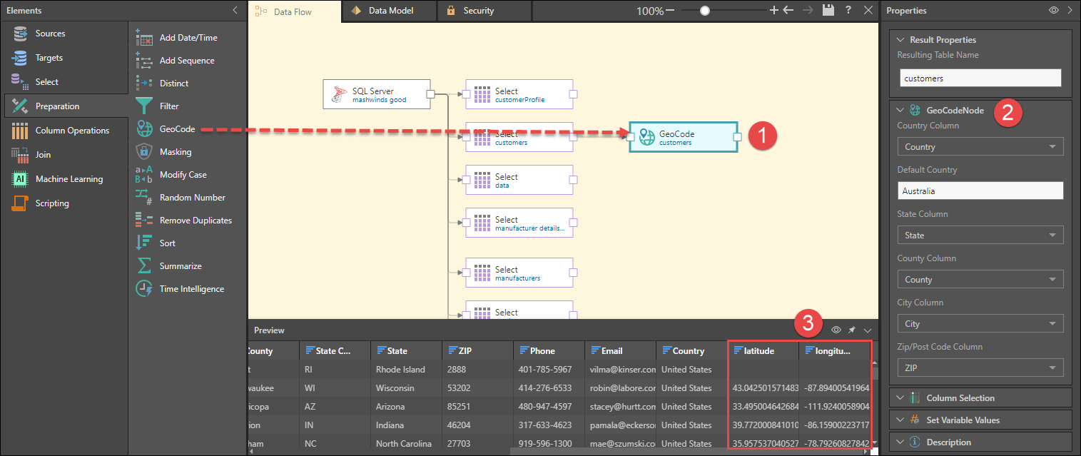
Generate latitude and longitude columns from tables containing geographical locations. The columns generated can later be used in map visualizations in Discover.
How to Configure a GeoCode Node
- Connect the GeoCode node to a table containing geolocation columns.
- From the node's Properties panel, go to the GeoCode Node window and configure the columns that will be used to generate the latitude and longitude columns:
- Country Column: select the column containing countries.
- Default Country: select the default country from the country column.
- State Column: select the column containing states.
- County Column: select the column containing counties, if relevant.
- City Column: select the column containing cities.
- Zip/ Post Code Column: select the column containing postal codes.
- Preview the GeoCode node to see a preview of the table with the latitude and longitude columns.
