Geo heat maps are used to represent the map's measure as a range of colors. When working with shape maps, several formatting options are afforded that enable you to design the map according your needs. For instance, you can select the specific map type, customize the map colors, add zoom control buttons, and more.
Settings
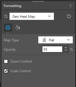
Go to the Settings tab to set the map type, opacity, and controls:

Map Type: choose the required map type.
Opacity: change the opacity of the bubbles.
Zoom Control: add zoom controls to the map.
Scale Control: show or hide the scale control.
Optimize Visual: the visual optimization engine in Pyramid is a heuristic that automatically redacts certain parts of a graphical visualization based on the amount of space provided.
Fill
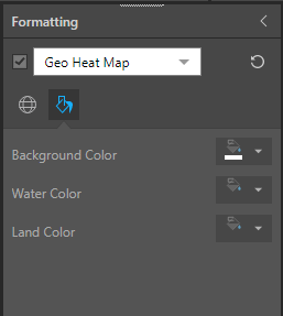
Go to the Fill tab to change background and map colors:

Background Color: change the color of the report background.
Water Color: change the color of the water.
Land Color: change the color of the land.