A geo-boundary is a type of context calculation that is used to create a custom column which divides the map into 2 members: "in" (the geo-locations within the radius of the geo-boundary), and "out" (the geo-locations outside the geo-boundary). This provides the option of splitting the map into different 'sections,' which can then be used to drive which part of the map is displayed.
Note: this feature is not supported for OLAP, Tabular, or SAP BW data sources.
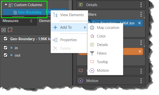
The geo-boundary custom column is automatically added to the Details drop-zone, and also appears under Custom Columns in the Dimensions panel.
This resulting column can be added to any of the following drop zones:

Create a Geo-Boundary
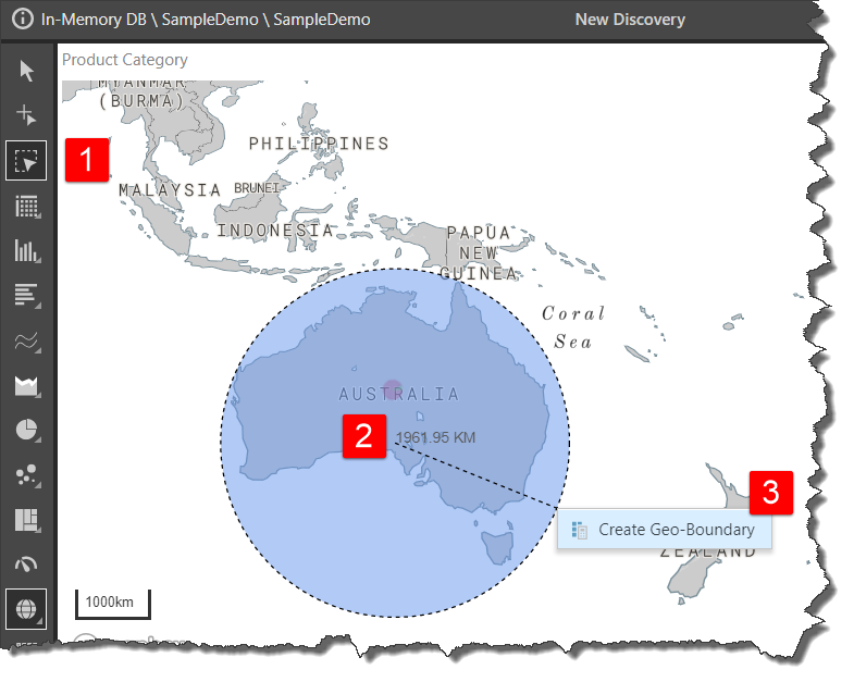
- Select the lasso tool.
- Click and drag over the area that should be included in the geo-boundary. In this example, a geo-boundary is created to include all of Australia.
- Click Create Geo-Boundary.

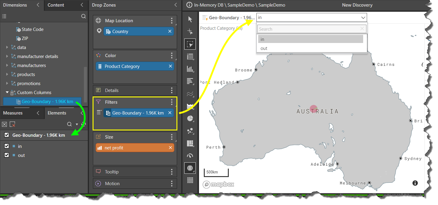
The geo-boundary custom column will be created and added to the Dimensions panel; to view or select its elements open it's Elements Tree (green arrow).
The geo-boundary chip automatically added to the Details drop zone; in this example it was moved to the Filter zone to create a slicer (yellow arrow) that will drive which region of the map is in view. When 'in' is selected from the slicer, the map will focus on Australia; when 'out' is selected, the map shows all regions outside of Australia.

Limitations
The creation of geo-boundaries is constrained by the type of map visual; a geo-boundary can only be created from a bubble map. However, an existing geo-boundary chip, that was built using a bubble map, can be added to the drop zones when working with shape and heat maps.